`Remember me on this computer` option
Select the `Remember me on this computer` option if you wish to be automatically logged on to the computer in future. Your account will remain active for 45 days. Please do not use the `Remember me` option if using a computer with public access or that is used by more than one person.
Seller information

Sold and shipped by
Return of order


View more related products to:
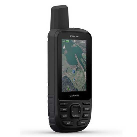
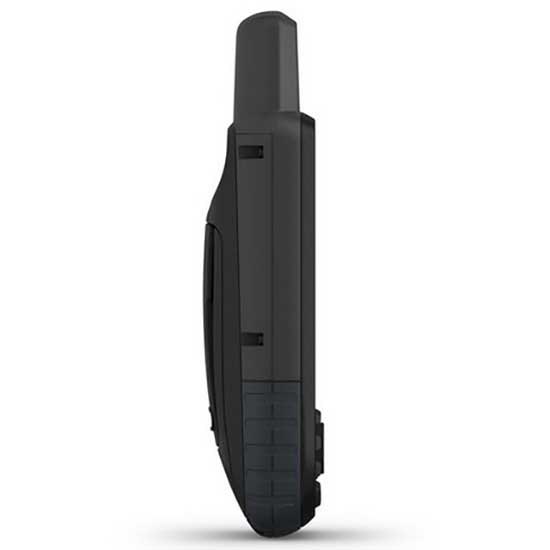
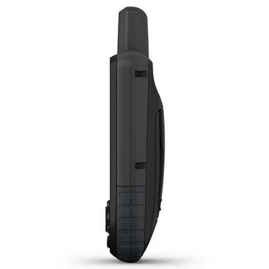
If you count with a device like GPSMAP 66ST, you will get the exact location of the routes of your preference. This device is composed of a 3´´ screen that remains readable despite receiving the impact of sunlight. Inside, it has altimeter, barometer and compass; with these tools you will predict data such as elevations and descents in the road, the climatic changes that may occur and estimate the distance traveled.
Its connectivity is wireless and allows updating updated and animated weather forecasts. Through the Garmin Explore application, you get interesting information about specific places and know the exact time of the duration of the tours. In addition, you will see satellite images that you can download on your device, at no additional cost. Within its functionalities, you will have access to the topographic maps of the USA and Canada.
If you want to use the LED light of the device you will have 16 hours, but with fewer activities of use its duration will extend to one week.
Premium GPS handheld with BirdsEye Satellite Imagery subscription and TopoActive maps
- Large, 3 sunlight-readable colour display for easy viewing
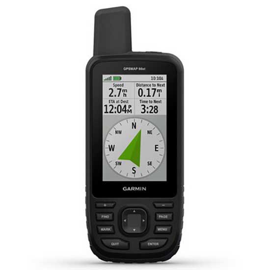
- Multiple Global Navigation Satellite Systems (GNSS) support to track your travels in more challenging environments than GPS alone, plus three-axis compass and barometric altimeter
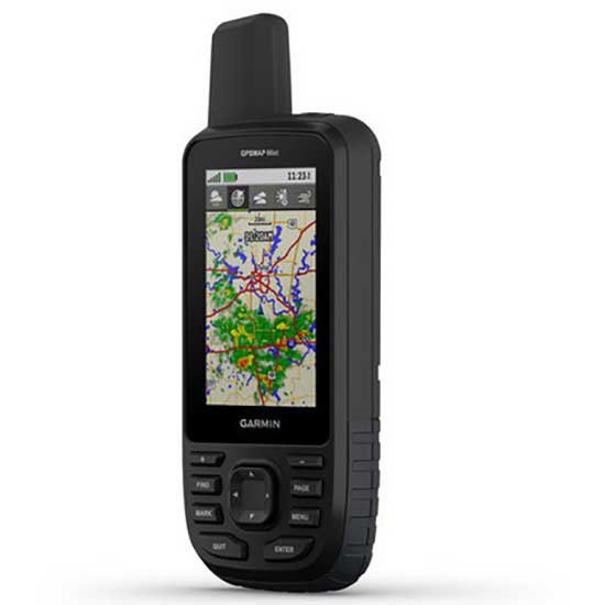
- Access to BirdsEye satellite imagery with direct-to-device downloads and no annual subscription, and preloaded TopoActive European maps
- Expanded wireless connectivity supports Active Weather for up-to-date forecasts and animated weather radar, and Geocaching Live for mobile syncing and updates
- Compatible with Garmin Explore website and app to help you manage tracks, routes and waypoints, and review statistics from the field
- LED flashlight function plus up to 16 hours of battery life in GPS mode and 1 week in expedition mode for fewer charges
- Navigate your next outdoor adventure with the GPSMAP 66 series. Whether youre hiking, mountain biking, climbing, geocaching, kayaking or working in outdoor environments, you can explore more with this iconic, rugged handheld with a 3 colour display. It features access to BirdsEye Satellite Imagery subscription with direct-to-device downloads to help you find your way, plus preloaded TopoActive European maps on GPSMAP 66st. And it offers multi-satellite support as well as wireless connectivity for Active Weather, direct downloads and Garmin Explore compatibility.
Get your bearings:
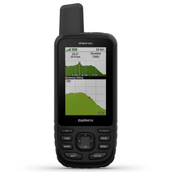
- In addition to multi-GNSS support, the GPSMAP 66 series provides ABC (altimeter, barometer and compass) sensor capabilities to track your journey. The built-in altimeter provides elevation data to accurately monitor ascent and descent, while the barometer can be used to predict weather changes by showing short-term trends in air pressure. The three-axis electronic compass keeps your bearing whether youre moving or not.
See where youre headed:
- Get a better picture of your location with high-resolution photo-realistic views of your route, thanks to direct-to-device downloads of BirdsEye satellite imagery without an annual subscription. Youll see a true representation of your surroundings to find trails, trailheads and clearings for campsites, to find parks and parking for geocaching, and even to create waypoints based on landmarks.
- Plus, GPSMAP 66st comes preloaded with TopoActive European maps. Youll see every hill and valley, with more detail than ever including terrain contours, topographic elevations, summits, parks, coastlines, rivers, lakes and geographical points.
Stay tuned to conditions:
- Youll always stay informed of weather conditions when you pair your GPSMAP 66 series device via Bluetooth® to a compatible smartphone. Receive Active Weather updates for real-time forecast information, including predictive maps for temperature, wind, precipitation and clouds. It also provides live weather radar so youre aware of inclement weather that can affect your outdoor adventures.
Find your cache:
- GPSMAP 66s and GPSMAP 66st devices make it easier than ever to enjoy your geocaching experience. Set it to automatically update with all the latest caches from Geocaching Live, including cache descriptions, logs and hints. With a Wi-Fi® connection or through Garmin Connect on a compatible smartphone, youll avoid manually entering coordinates or printing out cache details on paper and each find will automatically upload to your profile.
Explore with Garmin:
- Even when youre offline and have no mobile connection, the GPSMAP 66 series pairs with the Garmin Explore mobile app to let you plan, review and sync data, including waypoints, routes and tracks. Plus, you can review completed activities while still in the field, even when youre off the grid.
Utility in adverse environments:
- Be prepared for the most extreme adventures. The GPSMAP 66 series offers up to 16 hours of battery life in GPS mode and 1 week in expedition mode (with two AA batteries) for fewer charges. It provides an LED flashlight and SOS beacon that can be used to signal for help. Its built to military standards for thermal, shock and water performance (MIL-STD-810G), and its even compatible with night vision goggles.
Specifications:
General:
- Physical dimensions: 6.2 x 16.3 x 3.5 cm
- Weight: 230g with batteries
- Water rating: IPX7
- Battery: 2 AA batteries (not included); NiMH or Lithium recommended
- Display type: Transflective colour TFT
- Display size: 3.8 x 6.3 cm; 3 diagonal
- Display resolution: 240 x 400 pixels
- Memory/history: 16 GB
- High-sensitivity receiver:
- Interface: High-speed USB and NMEA 0183 compatible
Maps & memory:
- Ability to add maps: Yes
- Basemap: Yes
- Storage and power capacity: microSD card (not included)
- Waypoints/favourites/locations: 10,000
- Routes: 250
- Track log: 20,000 points, 250 saved gpx tracks, 300 saved fit activities
- Preloaded maps: Yes (topographic)
Sensors:
- Barometric altimeter: Yes
- Compass: Yes (tilt-compensated 3-axis)
Outdoor recreation features:
- Area calculation: Yes
- Automatic routing (turn by turn routing on roads): Yes (with optional mapping for detailed roads)
- Geocaching-friendly: Yes (Paperless)
- Custom maps compatible: Yes
- Hunt/fish calendar: Yes
- Sun and moon information: Yes
- Camera: No
- Picture viewer: Yes
Garmin Connect:
- Garmin Connect compatible (online community where you analyse, categorise and share data): Yes
Additional:
- Garmin Explore compatible: Yes
- Garmin Connect IQ compatible: Yes
- Wireless compatible: Yes (Wi-Fi, Bluetooth and ANT+)
- Map segments: 15,000
- Active weather: Yes
- Smart Notifications: Yes
- Live Tracking: Yes (with) Garmin Connect Mobile
- BirdsEye direct to device: Yes (no annual subscription required)
- MIL STD 810G ruggedness for thermal, shock and water performance
In the box:
- GPSMAP 66
- Access to BirdsEye satellite imagery (no subscription required)
- USB Cable
- Carabiner with clip
- Documentation
Discover the full range of outdoor products from Garmin that we have in stock and at the best price. At trekkinn, your online outdoor store allows you to buy online our top product Garmin GPSMAP 66ST GPS from your house with all the guarantees of sending within 24/48h.
Write a review about this product and earn CoINNs 
4.5 / 5
3 Reviews


Gps all-time
Barri - 19/08/2019
It is a GPS for use in summer and especially in winter, for use by keys with gloves. Very configurable in terms of menu preferences. Its use requires a certain technological skill. Its software is updated by Wi-Fi and maps are passed by Bluetooth from Wikiloc. Very good synchronization with the mobile. Nobody expects the fluidity of a mobile because this is what it is for. Still, more than enough. Very very happy.
My purchase of garmin gpsmap 66st
Alejandro Faraldo - 12/05/2019
I am very happy with the purchase, although the maps it allows to install are still very basic. I have the Garmin gpsmap 60Csx, but it has become obsolete, with new programs and improvements in features. Next step buy the maps, more updated as: Garmin TOPO Spain v6 PRO.
Very good gps for mountain
Alfonso - 15/02/2019
Robust, reliable and very good screen visibility. At the beginning, it costs a bit to get used to the menus and options through the keys since it has many options and configurations. But the one you get used to is very powerful. Very good buy. On the part of Trekkin I send it in perfect time and without problems. I have already made several purchases with them and everything is correct.
Write a review about this product
Tradeinn Retail Services as the data controller will process your data in order to respond to your query or request. You can access, rectify and delete your data, as well as exercise other rights by consulting the additional and detailed information on data protection in our Privacy Policy.

30-DAY
EASY & FAST RETURN

SECURE & SAFE
SHOPPING

SATISFACTION
100% GUARANTEED

LOWEST PRICES
GUARANTEED
Related products
Close
ABOUT trekkinn

SHOP WITH CONFIDENCE
CUSTOMER SERVICES
4.5 / 5

By Verified Reviews
OUR TRIATHLON CLUB

DOWNLOAD OUR APP


Follow us on


Departments
Top Brands


Copyright 2009 - 2024 by trekkinn. TRADEINN RETAIL SERVICES, S.L. CIF/VAT ES-B-17527524, C/ Pirineus, 9, 17460 Celrà (Girona), Spain. Terms & Conditions | Affiliate programs | Cookies policy | Privacy policy | Legal notice | Privacy policy social networks


 Returns
 Help & Contact
 Shops
Shops


 Nutrition
 Other sports


 Legal information


 Pay in 3 interest-free instalments.